

BIN LORRIES TO MAP MOBILE COVERAGE IN £34K SOUTH YORKSHIRE PROJECT FUNDED BY MAYOR
Published 7 August 2025 at 11:30am
Bin lorries are being used in an innovative project to map mobile phone coverage across South Yorkshire to help to identify signal ‘not spots’ and improve digital connectivity for residents and businesses.
The 12-month, £34,000 project, being funded by the South Yorkshire Mayoral Combined Authority (SYMCA), will allow residents to check their coverage at home, on the commute and at work so that they can make an informed choice before signing up to a mobile deal.
Working with mobile analytics specialists Streetwave, the project is gathering real-time data on mobile signal strength, upload and download speeds, and network frequency across Barnsley, Doncaster, Rotherham and Sheffield.
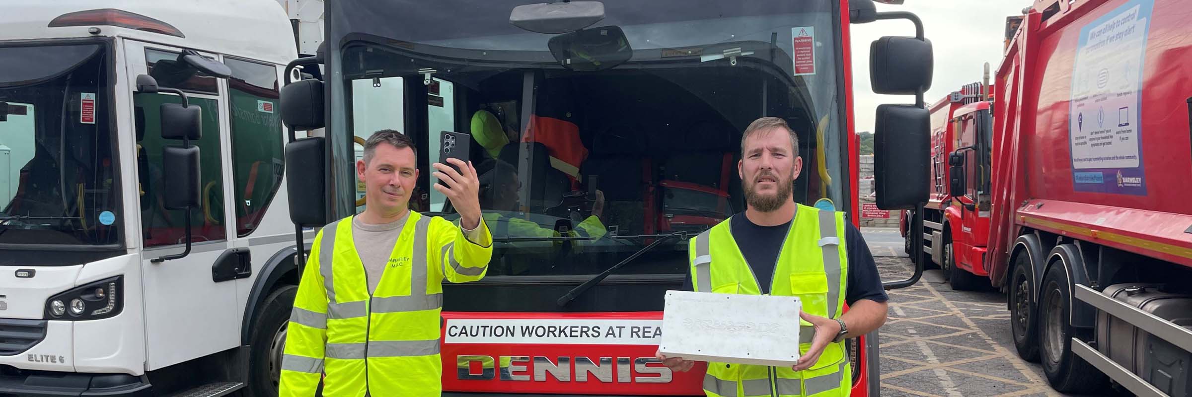
It uses Streetwave’s specialist measuring equipment, which is being carried on recycling trucks and street sweepers during their regular rounds. The data collected will then be used to create a free, clickable online map and postcode checker, allowing people to see which of the UK’s four main mobile network operators – EE, 02, Three and Vodafone, offer the best coverage in their area.
The project has begun in Barnsley and will be rolled out across Doncaster, Sheffield and Rotherham, with a second full round of mapping to follow to ensure accuracy and consistency.
South Yorkshire’s Mayor, Oliver Coppard, said: “Digital connectivity isn’t a luxury – it's a necessity. Whether it’s accessing public services, running a business or just staying in touch with friends and family.
“Too many people in South Yorkshire are still stuck in mobile ‘not spots’ where coverage is patchy or non-existent.
“That’s why it’s important this project is giving us the data we need to change. To make sure everyone in South Yorkshire can get the signal they need, wherever they live.”
This vital mapping project will provide a detailed, street-by-street view of mobile connectivity and coverage, helping to highlight areas with poor or no signal, supporting SYMCA’s work to push for better coverage across the region and assist local authority planning teams when considering applications for new masts and infrastructure.
The postcode checker and interactive map will go live once data collection is complete in each area. It’s expected Barnsley’s data will be available to the public in the coming weeks.
The latest news...
To find all of our press releases and news stories visit our dedicated news section